Danube Panorama Project
Longterm Panoramic Linescans of the Danube River (2005)


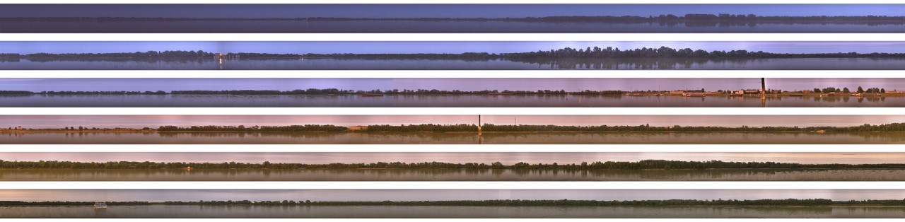
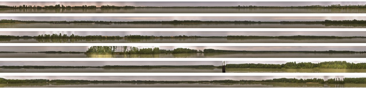
The Danube Panorama Project is an experimental approach to photographic mapping and cartography. It's goal is to produce a huge panorama of the Danube's river sides by digitally slit-scanning its coastlines, resulting in a unique 'cross section' of contemporary Europe.
The Danube - "Europe's River of Destiny" - connecting Western, Central and Eastern Europe uniquely reflects the shifting relationships of its peoples, cultures and religions in its accumulated history and contemporary dimensions. It is as much a cultural as a geographic landscape. It will guide as a symbolic red line of this intense survey.


Read more:
Felix Stalder: Rendering a River. On the Danube Panorama Project by Michael Aschauer,
Notes & nodes: society, technology and the space of the possible, 2023
Michael Aschauer: Danube Panorama Project - Eine künstlerische Uferkartographie,
In: Christian Reder, Erich Klein: Graue Donau, Schwarzes Meer, Springer, 2008
see also:
The Danube Panorama Project (rev.) (2022)
River Studies (2005-2017)
awared with an Honorary Mention at the by Prix Ars Electronica 2006 / Net Vision